Related Articles
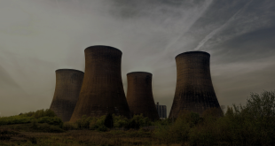

Insurance companies are pretty hard headed when it comes to mapping risk. With this in mind, insurance companies in the USA will be studying the new US Geological Survey seismic activity maps that show one of the US fracking regions in Oklahoma to have the same risk of damage from man-made earthquakes as California has from its natural fault lines.
The US Geological survey mapping is used by state emergency managers when they allocate resources:
“This report can be used by government officials to make more informed decisions as well as emergency response personnel to assess vulnerability and provide safety information to those who are in potential danger. Engineers can use this product to evaluate earthquake safety of buildings, bridges, pipelines and other important structures.”
Private insurance companies make a similar assessment when considering the likely risks on the policies they issue. It is unlikely that those areas now included as at risk of man-made earthquakes are going to be seeing anything other than rises in premiums.
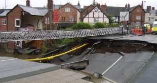
In the UK, where insurers often refuse to issue policies where properties are deemed to be at risk of flooding, the added risk of fracking-related earthquakes is likely to result in additional blight, as premiums rise for properties above or adjacent to fracking activity.